Maps and brochures
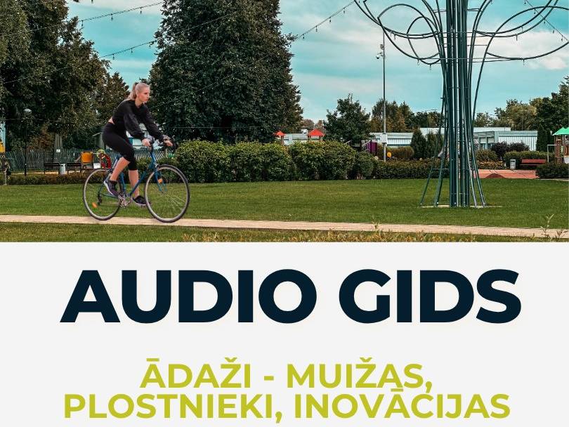
Cycling Route with Audio Guide
In collaboration with the Carnikava Local History Centre, the first audio guide in Ādaži Municipality has been developed, inviting visitors to explore the region’s cultural and historical heritage by bike.
The route (approximately 12 km) leads through the most significant cultural and historical sites in Ādaži Parish – from former manor estates and Soviet-era buildings to contemporary landmarks. It is suitable for families, students, history enthusiasts, and anyone wishing to discover Ādaži as a place full of stories, not just a dot on the map.
The audio guide is available for free via the “izi.Travel” app.
Search for:
“Ādaži: Manors, Rafters, Innovations”
or use the direct link: https://ej.uz/audiogidsmuizasplostnieki
The route is circular – it starts and ends in the centre of Ādaži, at Līgo Square. The full experience takes approximately 1.5 to 2 hours. Available in both Latvian and English.
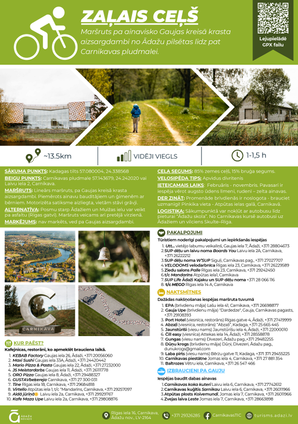
“Green Way” – Walking and Cycling Route
In Ādaži Municipality, a 13.5 km long protective dam stretches from the Gauja Bridge near Kadaga to Carnikava Beach – a safe and scenic route ideal for walking and cycling.
The dam connects Ādaži and Carnikava and is suitable for families, cyclists, and pet owners. Beautiful views of the Gauja River can be enjoyed year-round.
Route information:
- Start/End: Gauja Bridge – Carnikava Beach
- Length: 13.5 km (~1.5–2 hours by bike)
- Difficulty: Moderately easy
- Access points: Several entry points along the route
- Carnikava section: Gauja Promenade
- To the sea: Turn right onto Carnikava Promenade
Map: https://ej.uz/gecz
The route is available here.
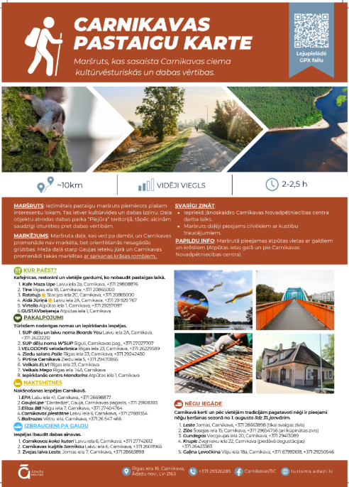
“Carnikava Walking Map” – Walking and Cycling Route
Carnikava offers a special walking route approximately 10 km long, designed to showcase the village’s cultural, historical, and natural heritage. This peaceful and educational route is suitable for a wide range of visitors – both locals and tourists.
The trail passes notable cultural landmarks and scenic natural spots. A portion of the route runs through the “Piejūra” Nature Park, so we kindly ask visitors to respect the environment and follow nature protection guidelines.
Route information:
- Length: ~10 km
- Duration: Approximately 2–2.5 hours
- Difficulty: Moderately easy
- Accessibility: Partially accessible for people with mobility impairments
Route available here
Other Maps of Ādaži Municipality
To help you explore Ādaži Municipality and its diverse offerings more easily, a selection of clear and informative maps is available. These maps highlight tourist attractions, points of interest, and local businesses, including addresses, contact details, and locations — perfect for planning day trips or everyday visits.
The maps are available digitally and can be viewed via the links below: